 Scottholm Neighborhood Documented by Cornell Studentsby Samuel D. Gruber
Early in December representatives from the city's Bureau of Planning & Sustainability and students from Cornell University's Historic Preservation Program presented some of their results of a survey of 175 residential properties in Syracuse's attractive Scottholm neighborhood, on the East Side, two miles from downtown.
Dick Case has already reported on the presentation and summarizes some of the findings in the
Post-Standard, but I present some additional information and my own take on the history and the process.
The Cornell group presented their work in an attractive booklet that summarizes the history of the neighborhood and its development as well as the various styles of domestic architecture built - mostly during the 1920s. The publication is available on the City's website, through the Bureau of Planning & Sustainability page:
http://www.syracuse.ny.us/uploadedFiles/Departments/Planning_and_Sustainability/Content/Scottholm%20booklet%20-%20FINAL_small.pdf. a color-coded map showing all house and street names and numbers and the periods of developments is particular helpful (especially to people like me who need help labeling photos when the house number is clearly visible).

Much of the booklet is taken up with reprinting style definitions from standard handbooks, but this may be useful to area residents, especially when the styles are applied to specific neighborhood houses, a few of which are featured as "house spotlights." Because of the nature of the accessible sources, most of the descriptive texts for individual houses is about the history of ownership with little specific information about the architect or designer, or the sources of the ready made plans.
It is often now impossible to recovery this information, or its take luck in finding plans, correspondence or recorded and signed contracts.
Development of the area began with creation of Genesee Turnpike, now Genesee Street in the 1830s, but what would became “Scottholm Estates” was sketched out in 1914 and lots were sold beginning in 1915. The survey identifies only about thirty houses as dating from from the 1915-1925. Most date from the late 1920s and some even from the early 1930s, suggesting the effects of the Depression took a while to by fully felt by Syracuse's white collar (and white color) commercial and other professionals, who made up a substantial portion of the neighborhood residents. Scottholm was designed by a landscape architect and planner Arthur C. Comey following the popular ideals for new garden suburbs easily reached by streetcar from urban commercial centers. These new developments, of which Syracuse has several notable examples, are typified by winding streets, mandated setbacks and front yards, organized tree-planting alongside sidewalks, and various protective covenants regarding ownership qualifications. The stone gates at the entrance to the neighborhood at Scottholm from East Genesee Street remain in place.
John W. Reps provides this
biographical information about Comey on his
invaluable website about American urban planning history before 1914:
Arthur Coleman Comey (1886-1954) graduated cum laude from Harvard University at the age of twentyone in 1907 with a degree in landscape architecture. His teacher, Frederick Law Olmsted, Jr. helped place Comey in his first two positions as a park planner in Dixon, Illinois and as Superintendent of Parks in Utica, New York. In 1911 Comey returned to Cambridge where he began his practice as "Consultant on City Planning." In 1912 the City of Houston, Texas, retained him to prepare a city planning report, and he wrote this article that October proposing a system of regulating building height and bulk and the minimum size of lots. In 1911 he decided to enter the international competition for the design of the Australian Federal Capital. Although he did not win a prize, his design was the second choice of the minority judge. Comey's career as a city planner had only begun. He entered and won second prize in 1913 in a competition sponsored by the Chicago City Club for the design of a typical 160 acre tract in that city. In 1914 he won first prize of $5,000 in a competition with 146 participants for the design of a 350 acre harbor, industrial, business, and residential complex at Richmond, California.
In 1914 he also began work on a study of suburban planning for the City Plan and Improvement Commission of Detroit. He also designed the garden suburb of Billerica, Massachusetts, a state-sponsored project. By 1917 Comey had served at least nine towns and cities, including Beverly, Brookline, Cambridge, Fitchburg, and Lawrence, all in the state of Massachusetts, and Woonsocket, Rhode Island.
He also was a Town Planner for the U. S. Housing Corporation in 1918 and 1919. Doubtless he drew on this experience during his twelveyear teaching career that began in 1928 when he was appointed a lecturer in the School of Landscape Architecture. He became an Assistant Professor in Harvard's School of City Planning and an Associate Professor in the Department of Regional Planning. During the 1930's and early 1940s he was also consultant to the U.S. National Resources Planning Board. With Max S. Wehrly Comey prepared a major study of American planned communities.
Comey was at one time an associate editor of the National Municipal Review and edited for publication in the Harvard City Planning Series a collection of the papers of Alfred Bettman. His own study for that series, Transition Zoning, published in 1933, reflects his interest in the legal and regulatory aspect of planning that he saw as necessary as ability in design. Among his other publications are Regional Planning Theory and Integration of the New England Regional Plan.
Comey helped found and became secretary and later vice chairman of the Massachusetts Federation of Planning Boards. He was a founding member of the American City Planning Institute in 1917 and was a member of its Board of Governors. He was a Fellow of the American Society of Landscape Architects, a member of the American Society of Civil Engineers, the American Institute of Consulting Engineers, and the American Planning and Civic Association. He was also president of the Boston Society of Landscape Architects.
His most elaborate contribution to Landscape Architecture was his "Regional Planning Theory: A Reply to the British Challenge," published in 1923. Illustrated with several line drawings and color plates, this advocated a policy of multidirectional city growth along radial transportation lines laid out on hexagonal patterns.
One interesting fact from the student's research is that a “considerable Jewish presence in the Scottholm tract, beginning in the first decades through the 20th century.” This reflects the first big move east of the City's more affluent Jewish community, especially those like the Marksons (documented here) in retail trade. According to the report: "A notable business in Syracuse, the Markson Brothers company specialized in the sale of furniture and other home goods. Started by four Polish immigrant brothers in 1905, Markson Brothers had stores in downtown Syracuse, Utica, Auburn, Oswego, and Rome. Several members of the next generation of Marksons continued to operate the business for years to come. Interestingly, several members of the Markson family decided to settle in Scottholm during its first years of development." The extended Markson family occupied at least four houses in the development.
The presence of Jews in Scottholm in its early years probably distingishes it from most other garden suburbs. However, it does reflect the outward migration of Jews from city centers that began even before the widespread development of ex-urban suburbs following World War II. Similar migration patterns of Jews (and other immigrant groups) along streetcar lines can be seen in Boston, Cleveland, Detroit and many other cities.

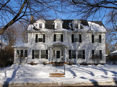
There are some large and distinctive houses in the neighborhood, especially on Scottholm Boulevard and the north end of Scottholm Terrance when some interesting houses are built high in and up on the hillside. But since most Scottholm houses were built at a time of design and material standardization. Structurally most houses are the same, and what is called "style" is most often only represents modest different - perhaps the angle of a roof line, the proportion of windows, the type of siding preferred, or the decoration. There is no historic and little social difference between a 1920s "colonial," "Tudor," or Spanish," house when built on the same street in the same neighborhood. Similar houses are can be found in developments across the United States. The most significant difference which might given some insight into the original owner's taste or status is whether the house is a standard purchased pattern from a book, builder's catalog or developments template or whether it is a unique architect-designed house. In Central New York as in most of country the former type is the norm.
We do have in Syracuse, however, houses designed by Ward Wellington Ward (such
Sanderson House at 301 Scottholm Blvd), Albert Brockway and a few others that have been documented, and possibly many others still to be researched. Some of these can be found in Scottholm. One of the most significant houses in the Scottholm neighborhood is excluded from the survey because of its relatively recent date, but this the Louis and Celia Skoler Residence at 213 Scottholm Terrace designed in 1957 by Louis Skoler (d. 2008). It is one of the most significance modern houses in the region, and is already listed on the National Register of Historic Places and as a designated local protected site (another fine Skoler House can be seen as 953 Comstock Ave. near the University where Skoler taught in the School of Architecture for 30 years).

The real meat of the Scottholm survey will be the reports on the history and architecture of the individual properties - and this has not yet been released. Katelyn Wright, a land use planner for the city says that it should be forthcoming early in 2011.
This survey is one small but necessary step in the improvement of the city's information regarding history and architecture. Relatively speaking - this project was an easy one - since it deals with properties built more or less at the same time under similar circumstances, and still occupied and well maintained. Fortunately, much information on such residential areas can be found through reviews of deed histories, city directories and importantly the real estate pages of the
Post-Standard which are quite informative for new development after about 1910. Alas, we lack such details reporting for most 19th century neighborhoods - especially those on the West and North sides. Since those are the areas more deteriorated and endangered, they are the areas that cry out for research and better listing on the city's historic property registers.
We have now documented the post-World War I houses and landscaped developments of Sedgewick, Berkeley Park Strathmore and Scottholm. We really need to turn our attention to the more distressed areas of the city.
Unlike in Scottholm, unfortunately this is work not so easily done as course work for students, and the City has not in the past allocated funds for this kind of work, and is especially short of resources now. The likelihood of being able to hire graduated (and experienced) preservationists to do this work is slight. It is hoped, however, that with the new committed staff at the city’s Bureau of Planning and Sustainability, that outside resources may be procured.
Meanwhile, local professional and organizations will as always be called on to fill the informational breach. In the past this has been mostly in reaction to specific threats, often at the eleventh hour and too late. It is hoped that the new preservation planners will be able to better identify endangered areas, and marshall talent and resources to these sites.
According to Katelyn Wright "With regard to a preservation plan, City preservation staff (Kate Auwaerter and myself) are currently in the preliminary stages of developing a strategic plan for the local preservation program. We expect this plan to include many of the strategies called for in the ESF plan and are consulting the faculty that were involved in that effort." The ESF plan was a major step forward in articulating a rationale city policy toward historic preservation, and clearly demonstrating links between preservation, land use, quality of life and economically sustainable development. Unfortunately, until now it has largely been ignored. You can read of copy of it here.
Katelyn and Kate will publicly share some of these plans and their thoughts on local preservation priorities at the PACNY annual meeting on January 23rd. Meantime, a one-page handout outlining the City's preservation policy and priorities is available here:
http://www.syracuse.ny.us/uploadedFiles/Departments/Planning_and_Sustainability/Content/Preservation%20Handout.pdf


.JPG)


