Thursday, April 5, 2018

Concord Place: Westcott Neighborhood's Village Green

Syracuse, NY. Concord Pl. Photo: Samuel Gruber.
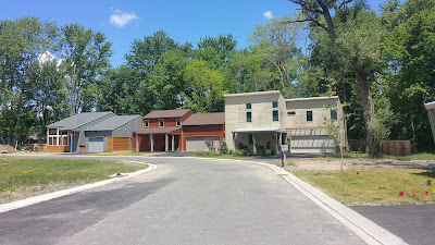
Syracuse, NY. Concord Pl. looking northeast. Photo: Samuel Gruber.
Syracuse, NY. Concord Pl. Porch of 116, looking east. Photo: Samuel Gruber 2018.
Syracuse, NY. Concord Pl., looking northeast. Photo: Samuel Gruber 2018
Concord Place: Westcott Neighborhood's Village Green
by Samuel D. Gruber

I recently wrote about  Euclid Terrace, the Westcott Neighborhood's hidden English village enclave. The development of Euclid Terrace in the 1920s may have been inspired by the success of the nearby, but much more public Concord Place, a one-block street between Westcott and Allen Streets that has divided carriageways that wrap around an elongated median that takes the form of an small urban park. 

The street is lined with impressive houses mostly built in the first decade of the 20th century. These include some of Syracuse's earliest examples of Arts and Crafts and craftsman houses, including an important work (125 Concord Pl) attributed to LaMont Warner and a transitional design by Ward Wellington Ward (126 Concord), which was one of the first of his many houses in the area. Other houses on the street are clearly architect-designed but we have not yet been able to make attributions.

Syracuse, NY. 125 Concord Pl. Lamont Warner House. Lamont Warner, architect, 1902. Photo: Samuel Gruber 2018
Syracuse, NY. 126 Concord Pl. John B. Tuck House. Ward Wellington Ward, architect, 1910. Photo: Samuel Gruber 2016

What is now Concord Place, was originally planned as a plain street known as Wickliffe Street, part of the Hillsdale Tract. Though Hillsdale was promoted in the 1880s, only a few houses were built before 1900, at which time residential development in the area increased rapidly and continued through the 1920s.

Syracuse, NY. Hillsdale Tract map, 1889. Photo courtesy Bruce Harvey.
Syracuse, NY. Hillsdale Tract amended map, 1893. Photo courtesy Bruce Harvey.

Contrary to common belief, Concord Place, with its unusual elongated oval form, is not in any way a continuation of the driving course which had covered most of the Hillsdale Tract earlier in the 19th century.
 
Syracuse, NY. 1892 map of Hillsdale Tract, including Wickliffe St (to be renamed Concord Place), detail from Atlas of the city of Syracuse, Onondaga County, New York .  (New York: J.W. Vose & co., 1892).
Atlas of the city of Syracuse New York (Philadelphia : G.M. Hopkins Co., 1908). Detail of Concord Place.

In 1893 the design of the tract was amended with a new map by Mather & Allen, civil engineers. The number of lots slightly lowered, and Concord Place was given its current form.  In 1924 the green space was clearly designated as Concord Park.
 
Already by 1908 about half the present-day houses were built on Concord Place; five on each side of the street. The Lamont Warner House, believed to have been built in 1902 by the designer (who moved to Syracuse in 1900), was already complete on a double lot at the northwest corner of Allen Street and Concord Place. The rest of the 600 and 700 blocks of Allen Street were still undeveloped at the time.

Impressive Craftsman-type houses, with steep roofs with large gables and projecting multi-window dormers, shingle siding, and expansive porches are especially found on the north side of the street. These are transitional designs and also incorporate some elements common to the large late Victorian houses found on the 400 block of Allen street, and which at time were called "Colonial," in part because of the use of Palladian windows and other small classical, Renaissance or Adamesque features.

Number 119 and 121 were both built after 1908 - probably around 1910.Both houses utilize elements of the Craftsman style including the high wide gable and projecting eaves, but in a more regular way. We can see even with these large houses that certain patterns are now being more regularly followed by builders. It is quite likely that these two houses on adjacent lots were built by the same developer at the same time. They are not quite twin houses, but share their most important design elements. There are little different form the many Four Square houses being built nearby in the 600 block of Allen Street, except they gable roofs (instead of hipped) and the prominent gabled dormers.


Syracuse, NY. 117 Concord Pl. (before 1908). Photo: Samuel Gruber 2018.
Syracuse, NY. 113 Concord Pl. (before 1908). Photo: Samuel Gruber 2018


.


Syracuse, NY. 119 Concord Pl. (after 1908). Photo: Samuel Gruber 2018.
Syracuse, NY. 121 Concord Pl. (after 1908). Photo: Samuel Gruber 2018.

Other early houses on the street mix late 19th- and early 20th-century residential fashion in different ways. Number 105 is dominated by a large round corner tower. Though the main body of the house appears to be an example of the then popular hipped-roof Four Square type, the tower creates a very different impression. Though the house is smaller than the Babcock-Shattuck house at Westcott and East Genesee Streets, the role of the tower is the same. The hipped roof also sprouts an unusual polygonal dormer.

Across the street at number 116, there is a vestigial round tower on the side of the house, now just a projecting bay. The roof is a cross-gable construction, but the front-facing gambrel roof and gable, incorporating the so-called dutch Colonial Revival style popular after 1900. Like most of the house on the street, number 116 has a grand open porch looking onto the center park.

Syracuse, NY. 105 Concord Pl. (before 1908). Photo: Samuel Gruber 2018.
Syracuse, NY. 116 Concord Pl. (before 1908). Photo: Samuel Gruber 2018..

By 1924, as seen on the map, the entire block was now filled in and 7 of the earlier 10 houses had added small detached garages in the rear and the end of their side driveways. New houses on the south side of the street include a bungalow and a curious brick bungalow-type houses.
 
Atlas of the city of Syracuse, N.Y. and suburbs (Philadelphia : G.M. Hopkins co., 1924). Detail of Concord Place.
Syracuse, NY. 106 Concord Pl. Bungalow.  Photo: Samuel Gruber.
Syracuse, NY. 108 Concord Pl. Bungalow.  Photo: Samuel Gruber.


Concord Place is just one of several streets throughout the city that are designed with significant green space - either a median or a park - dividing directional carriageways in the manner of a parkway. A comparable short block is on the North Side at the 700 block of North McBride Street.

A slightly earlier example of a similar type on the East Side is Walnut Park, developed by George Comstock. The park runs several blocks between Walnut Place and Walnut Ave.  Deeded to the city in 1870 as the heart of a new development area the park was lined with substantial homes and some mansions around 1900, most of which have served as Syracuse University fraternities and sororities since the 1920s.  It is quite likely that the Hillsdale developers’ decision to alter the form of Concord Place was influenced by the Comstock development, in the hope of making the block a more exclusive enclave.

Syracuse, NY. Walnut Park. Photo: Samuel Gruber.
A similar design, but with narrower parkland, is Shotwell Park and adjacent Melrose Avenue in Eastwood.

This “greening” of the city was even more popular in the first decades of the 20th century influenced by the practical urban landscape work of the Frederick Law Olmsted and his followers, such as Arthur Coleman Comey, who designed the Scottholm subdivision. On the East Side of Syracuse these developments are more common in Garden Suburb developments (Berkeley Drive, Scottholm Boulevard) in even further East in Bradford Hills (Bradford Parkway, Old Lyme, Hillsboro Parkway, etc.).

Syracuse, NY. Concord Pl. Porch of 116, looking northeast. Photo: Samuel Gruber 2018.


Friday, March 16, 2018

Euclid Terrace: Westcott's Secret English Village

Syracuse, NY. Euclid Terrace. Entrance from Eculid Ave. Photo: Samuel Gruber 2017.

Syracuse, NY. Euclid Terrace. Entrance from Eculid Ave.Photo: Samuel Gruber 2017.

Syracuse, NY. Euclid Terrace. "Village Green." Photo: Samuel Gruber 2017.
Euclid Terrace: Westcott's Secret English Village
by Samuel D. Gruber (with Bruce Harvey)

Residents of Syracuse's Westcott and University neighborhoods know that despite the organizing principle of the orthogonal grid, there are many urban nooks, crannies, and irregularities to be discovered tucked into, over, or between the straight streets and ninety-degree corners that define the area. The imposition of the grid by various developers at the turn of the 20th century had to take into account a few earlier irregular roads and the many drumlins in the area; those geological lumps and bumps that dot the East Side landscape.

One secret spot is Euclid Terrace, designed as a bit of English Village hidden just a stone's throw from the busy intersection of Westcott Street and Euclid Avenue. Whether you are picking up a six-pack at Grabby's, attending a concert at the Westcott Community Center or church at Erwin Methodist, you might not even know you are right next to Euclid Terrace. While some of the houses have property lines along Westcott, these houses turn there backs to the hustle-bustle, and the sidewalk lies at the bottom of a steep slope.

Euclid Terrace as seen in the 1924 Hopkins map. You can see the south part is developed, but not the "Village Green".

Euclid Terrace sits atop a small drumlin on the east side of the 700 block of Westcott Street and the west side of Strong Avenue between Clarke Street on the north and Euclid Avenue on the South. This high point remained vacant as lower flatter land on all sides was platted and developed in the late 19th and early 20th centuries  By 1908, for instance, the east side of Strong Avenue (originally part of a continuous South Beech Street), was fully developed with eleven houses, but nothing was built either into or on top of the hill on the east side.

But in the 1920s the parcel was developed into a picturesque cul-de-sac. This type of planned space is unique in the Westcott neighborhood, though it recalls Westminster Place, developed as a street and small circular part nearby atop another high point.

Syracuse, NY. Euclid Terrace. Photo: Samuel Gruber 2017.

While today Euclid Terrace has a variety of house types encircling its central round about, it is most known for its collection of small unique English cottage style houses developed by Joseph Lane & Clifford Goes in the 1920s.

The west side of Strong Avenue, the location of what is now Euclid Terrace, was owned in the early 20th century by Mary Barber and was undeveloped. Barber also owned a larger tract south of Euclid Avenue. This small tract of Euclid Terrace was platted and filed in the spring of 1911. Located on the north side of Euclid Avenue, this triangular tract was bordered on the west by Westcott Avenue and on the east by Strong Avenue which angled from southeast to northwest; it bordered to the north on a large lot that also fronted on what is now Clarke Street.

No doubt the opening of Erwin Methodist Church across Euclid Avenue in 1914 brought greater visibility to this almost invisible and inaccessible parcel.

Syracuse, NY. Erwin Methodist Church at Euclid Ave. and Westcott Street, original design by Justus Moak Scrafford, 1914.

The Euclid Terrace tract remained undeveloped through the 1920s, and a revised plat was filed in late 1920. The revised tract included a more auto-friendly turn-around at the northern end of the access road, now Euclid Terrace, with two lots on the east side and five lots on the west, three of which backed up against on Westcott Street at the northeast corner of Euclid Avenue. This revision inaugurated the development of the new single-street tract, which took place through the 1920s.

Syracuse, NY. Euclid Terrace tract map, 1911.
Syracuse, NY. Euclid Terrace tract map, revised 1924.

The southern portion of the tract was developed first, and by 1924 included six houses that fronted on Euclid Avenue and one that fronted on Westcott Street. The northern portion of the tract was subdivided into building lots through the 1920s, and by 1938 almost the entire tract had been developed, including more than 20 houses.

Syracuse, NY. Euclid Terrace. Photo: Samuel Gruber 2017.


Its location, close to a major intersection and trolley line but set apart as a new almost private cul-de-sac, would have had great appeal in the 1920s as it still does today. 

The tract was developed by the general contracting firm of Lane & Goes; rather than targeting moderate-income buyers with affordable homes on small lots, Lane & Goes built distinctive homes that had “the individual distinction shown in an ‘architect-designed home.’”   

As an advertisement 1927 noted, the Euclid Terrace tract is “Located in the smartest and most beautiful residential section of University Hill...a highly restricted colony of artistic homes.” These homes, the advertisement continued, possess “the usual Land & Goes ultra-modern features.” It is not absolutely clear what "restricted" meant in this sense, but besides the specific message of exclusiveness, it probably literally meant that sales were limited to whites, and possibly Christians. We do know that Scotthom which was developed at about the same time refused people of color, but did allow Jews.

Unlike the vast numbers of houses built on most other tracts in what is now Westcott, these houses were frequently described in the local newspapers, often with drawings showing Tudor Revival and similarly English-inspired styles.As late 1924, however, only a few houses had been built on this cul-de-sac, but development by Lane & Goes picked up in 1925. A newspaper account reported “rapid progress” for the (then) 15 lots in the tract, with the developers limiting themselves to “small one-family houses especially designed for the terrace.”
Syracuse, NY. Euclid Terrace. Photo: Samuel Gruber 2017.

The Euclid Terrace remain something of an anomaly in Syracuse today. This type of scenic planning and the emphasis on English styles was, of course, developed further but on a much larger scale in the garden communities of Sedgwick, Berkeley Park, Scottholm and Strathmore, but small picturesque developments are rare. The use of the cul-de-sac and round-about as a residential neighborhood tool, however, became standard fare in the development of post-Word War II suburban housing tracts and it continues to be popular today.

Syracuse, NY. Xavier Woods. Development plan on sign. Photo: Samuel Gruber 2017.


One modern application of Euclid Terrace concept is the still-in-progress development of Xavier Woods off of Comstock Ave.  There a modern version of upscale developer-approved tract housing is a being built around a central green, in the way that almost a century ago, Euclid Terrace was developed.

I'm all for new development in the city. But for me, if I had to choose which urban "village" to live  in, it would be Euclid Terrace hands down for style, location and convenience.
(Thanks to Bruce Harvey who contributed information and maps about the 1911 and 1920 tracts).


[1] “Euclid Terrace Lots Developed,” Post-Standard (May 17, 1925)


Tuesday, January 23, 2018

From Towers to Turrets to Projecting Bays: The Democratization of High Style House Design

Syracuse, NY. Loomis House ca. 1890. 623 Euclid Ave. Photo: Samuel Gruber 2012
Syracuse, NY. Levi Chapman House. 321 Westcott Street, in process of "vinylization". Photo: Samuel Gruber 2012
From Towers to Turrets to Projecting Bays: The Democratization of High Style House Design
by Samuel D. Gruber

Its been frequently documented that high-style innovations and affectations in art and architecture - but also in cuisine, fashion and etiquette - trickle from the top down, often being simplified and standardized, so that much of what we commonly mistake for vernacular design is actually highly inflected interpretation and adaptation of class trappings. Of course, it works the other way too, and often the lowest street culture can influence or even be adopted as a trend by the arbiters of high-style taste. Grafitti Art, the Blues, Rock and Roll, and Hip-Hop are examples. But so are rustic masonry and exposed timber construction in architecture and design.

We can certainly see the trickle-down side of this at work in the architecture, design and construction of houses in the Greater Westcott Neighborhood, which in its entirety provides a primer on late 19th-century and especially early-20th century Middle Class residential aspirations and achievement. A look at the continuing diminution of corner towers - so prevalent in the Queen Anne style in the last decades of the 19th-century - is a good case in point.

Syracuse, NY. Babcock-Shattuck House. Photo: PACNY 2014
In 2013 I posted about Queen Anne style houses in the Westcott Neighborhood. Just before 1900, there were still some big houses of wealthy owners that sported impressive, attached corner towers. The recently restored Babcock-Shattuck House at 2000 East Genesee Street has a round corner tower, while the Loomis House at 623 Euclid Ave (corner of Lancaster Ave), and the Levi Chapman House at 321 Westcott Street, have large attached polygonal towers. 

The Loomis House is still relatively good condition, but the Chapman House has unfortunately been recently covered with vinyl siding. Both houses have their towers knit into the main building fabric with the tower roofs cut into the slope of the main roof much as a dormer would be. Though thoroughly integrated, the towers still stand as strong elements of the overall composition, and they are not obscured by porches. They give these houses the castle look of a baronial homestead.

After 1900, we see traces of similar towers on many houses, but these get lower and flatter and are sometimes obscured by porches. The houses at 108 Avondale and 708 and 714 South Beech Street are smaller than the Loomis and Chapman houses, but continue the form. The projecting corner tower still has its own polygonal roof.


Syracuse, NY. 108 Avondale. Photo: Samuel Gruber 2015
Syracuse, NY. 708 South Beech St. Photo: Samuel Gruber 2013
Syracuse, NY. 714 South Beech St. Photo: Samuel Gruber 2013
In the next shift, however. the tower has entirely morphed into a projecting polygonal bay surmounted it own prominent gable. It no longer is the corner of the house, but rather projects directly from the facade, filling about half the house width. Like the towers, the projecting bays still help to draw more light into the house by having windows facing three directions. Typical examples of this form are at 710 and 729 South Beech Street.

Syracuse, NY. 710 South Beech St. Photo: Samuel Gruber 2012


Syracuse, NY. 729 South Beech St. Photo: Samuel Gruber 2012
This form is related to another common type popular in the area from at least the early 1890s. This is a simple variation on the Queen Anne type, but stripped down and easy to build on a small lot. The type is defined by L- or T-shaped roof, with a cross gable, and projecting front polygonal bay. The narrow bay is surmounted by a prominent gable, and this is set against and almost within a larger gable that spans the entire house width. There are several examples on South Beech, Dell, and nearby streets, though more often the projecting bay is rectangular and not polygonal.


Syracuse, NY. 711 South Beech St. Photo: Samuel Gruber 2012
A simplification of this type does away with the extra smaller gable, and instead extends the primary gable over the bay, creating a little covered recess over the front door. An example of the this can be seen at 116 Clarke Street at the corner of Strong Ave.


Syracuse, NY. 116 Clarke St. Photo: Samuel Gruber 2012
A slightly more complex profile is created at 1007 Euclid Ave., just off Strong Ave. In this two-family "flats" type of house, the projecting bay is under the main gable, but a second gable is created over a second story porch that spans half the width of the house. The lower porch presses up against and partially obscures the projecting bay - all that is left of old corner tower.

It is only a small step from this to a form very common in the 1920s and visible in my own house at on Clarke Street. Here the projecting bay is only built on the second story. Down below the wall is flat and totally taken over by the porch. The upper story bay does, however, get its own gable. This does provide the simple frame house a lively profile that harks back two generations to the Queen Anne style.   

Syracuse, NY 1007 Euclid Ave. Photo: Samuel Gruber 2011
Syracuse, Ny 123 Clarke Street. Photo: Samuel Gruber 2016

That second story bay is very functional. It pulls in sunlight for much of the day since it has windows facing east, south and west. Is is one of Luna's favorite spots in the house (see photo below).
 

Wednesday, January 17, 2018

More 19th-Century Italianate Houses in the Greater Westcott Neighborhood

Syracuse, NY. 1326 Madison St. Photo: Samuel Gruber 2016
19th-Century Italianate Houses in the Greater Westcott Neighborhood
by Samuel D. Gruber

Three years ago I wrote a post about Italianate houses on the Eastside. As I noted then, there is only a small number since the area was sparsely inhabited during the third quarter of the 19th century when the style was most prevalent. Those Italianate houses that do stand were mostly farm houses along the major routes in the district, especially East Genesee Street and South Beech Street.

I am now researching a large part of the Eastside for the Greater Westcott National Register Historic Site nomination and I've some across a few more examples of the style - though I still know nothing about the history of these houses. Most surprising is the group of Italianate houses in the 1300 and 1400 blocks of Madison Street, which is one of the oldest settled stretches in the area. The 1892 map of the city shows that Madison, Cherry, Bassett, and nearby streets were already fully developed with houses at the time. In 2016 I wrote about the demolition of two Italianate houses on the 1000 block of Madison Street.

The most impressive of these houses is a handsome and beautifully maintained brick structure at 1326 Madison Street. Especially attractive is the saw-tooth detailing on the belt course and the raised brick patterns on the window arches.

Syracuse, NY. 1326 Madison St. Photo: Samuel Gruber 2016
There are also two large and attractive wood frame Italianate houses in the 1400 block of Madison Street. One of these, #1400-1402 on the corner of Cherry Street is now for sale. This sprawling structure with a good north view has long been a favorite of mine and now that it is for sale perhaps I'll get a look inside. It is listed as belonging to C. L. Hovey on the 1892 map of the area. Though the house has been re-sided and altered in other ways, its 19th-century form remains true. 

Both houses on the 1400 block have been added to, in the typical fashion of Italianate houses where extensions are added to the main cubic block. Sometimes these may be contemporary with the main structure and may have contained kitchen, storage and other utilitarian functions. It seems that the original blocks of both these house were not exact cubes, but were more T-shape in plan, allowing rear side rooms to get some north light.

these houses probably date from the 1870s or early 1880s.

Syracuse, NY. 1400-02 Madison St.at the corner of Cherry St.  Listed as belonging C. V. Hovey in 1892. Photo: Samuel Gruber 2016
Syracuse, NY. 1410-12 Madison St. Listed as belonging to M .M. Park in 1892. Photo: Samuel Gruber 2016
There are also a similarly-dated house on Bassett Street, an irregular street into which Madison ends, and which pushes up the steep hill from the former Erie Canal until it turns and intersects with South Beech Street. The Italianate house at number 133 has a wrap-around porch which appears to be original.

Syracuse, NY. 133 Bassett St. Photo: Samuel Gruber 2016
In the previous post, I mentioned one small Italianate house at 726 South Beech Street. There is another at #615. This is a simple two-story wood frame block with a ground floor projecting polygonal bay (probably the dining room). There is a later Colonial style (ca. 1900?) full-width ground floor front porch with an off center entrance beneath a small pediment. This once would have been decorated with a relief decoration. The house is now covered with vinyl siding, but because of its prominent siting it still holds its own.


Syracuse, NY. 615 South Beech St. Photo: Samuel Gruber 2011

Monday, January 15, 2018

Atonement Lutheran Church, a Modern Landmark on Syracuse's Southwest Side

Syracuse, NY. Lutheran Church of Atonement. Edgarton & Edgarton, archs (1962). Photo: Samuel Gruber 2014.
Syracuse, NY. Lutheran Church of Atonement. Edgarton & Edgarton, archs (1962). Photo: Samuel Gruber 2014

Syracuse, NY. Lutheran Church of Atonement. Edgarton & Edgarton, archs (1962). Photo: Samuel Gruber 2016
Atonement Lutheran Church, a Modern Landmark on Syracuse's Southwest Side
by Samuel D. Gruber

I began this post over a year ago after attending an excellent concert by the Onondaga Civic Orchestra at the Atonement Lutheran Church. It was the first time I'd been in the building and I was impressed by the aura and warmth of the spacious modern interior. I've previously written about several mid-century modern religious buildings in the region, such as Saint Daniel's Church in Lyncourt. Atonement Lutheran Church is certainly a modern icon on the Southwest side, one of several churches built in the decades after World War II to serve the expanding population and to take advantage of new building technologies and to cater to new modern aesthetic tastes.

This church was opened in 1962 and designed by the local architecture and engineering firm of Edgarton & Edgarton with input from the Dept. of Church Architects United Lutheran Church in America, and constructed by R. A. Culotti Co. Edgarton and Edgarton are best known locally for the design of the War Memorial of 1952. In 1959 they designed the shopping center (East Syracuse Shopper) at James and West Manlius Streets. Very little is known of the firm. L. Dexter Edgarton was a graduate of Syracuse University and in the 1950s the firm had an office in the Marine Midland Building downtown (if readers know more about the firm please let me know).

The Atonement church congregation moved from 1926 Midland Avenue where they had occupied since 1927 a Gothic Revival style parish house and community center designed by Frederick R. Lear. The planned sanctuary had never been built due to the Depression and World War II.

Syracuse, NY. Former English Lutheran Church of Atonement, Midland Ave. Parish hall and community house, Frederick Lear, arch (1928). Photo: Samuel Gruber 2012
Syracuse, NY. Lutheran Church of Atonement. Edgarton & Edgarton, archs (1962). Photo: Samuel Gruber 2014
The old and new buildings could not be more different. The 1962 structure is a large shed-like building constructed of concrete block and brick on the outside and redwood inside.  Some of the concrete block is ornamental, used to create decorative screens outside the tall side windows.  The most prominent feature is a tower at the entrance surmounted by a large aluminum cross. Inside there are several innovations.

Syracuse, NY. Lutheran Church of Atonement. Edgarton & Edgarton, archs (1962). Photo: Samuel Gruber 2014
The white Georgian marble table-style altar is free standing, said at the time to be the first free-standing altar in the region. This is surrounded by a large communion rail which can accommodate more than 40 people. There is little ornament inside the sanctuary, but a large plain white poplar cross is suspended from the ceiling in front of the plain brick eastern wall. The church was dedicated by Rev. Dr. John M. Joslyn, who had already been serving as pastor for five years when the 1928 building was dedicated.

 Architects Edgarton & Edgarton were already known for their engineering of the impressive 160-foot vault of the War Memorial. Though the Atonement Church is much smaller, they still attained a sense of vast space with the high wood ceiling raised on wood supports that also buttress the brick walls.
 
Syracuse, NY. Lutheran Church of Atonement. Edgarton & Edgarton, archs (1962). Photo: Samuel Gruber 2016
 History

The congregation was founded in a church dedicated in 1906 at the southeast corner of Brighton Ave. and Cannon Street, but by the spring of 1926 “the church building was no longer adequate to meet the needs of the enlarged Sunday School and Congregation, and the congregation was authorized by the Board of American Missions of the United Lutheran Church to dispose of the property as soon as possible and to lay plans for the erection of a new Church and Parish House.” In May 1927 the property on West Brighton was sold to the city of Syracuse to be used as a precinct station. On June 19, 1927 ground was broken for the erection of the Parish House and Community Center at the corner of Midland and Brighton Avenues. The cornerstone was laid November 13, 1927 and the building was dedicated in September 1928.